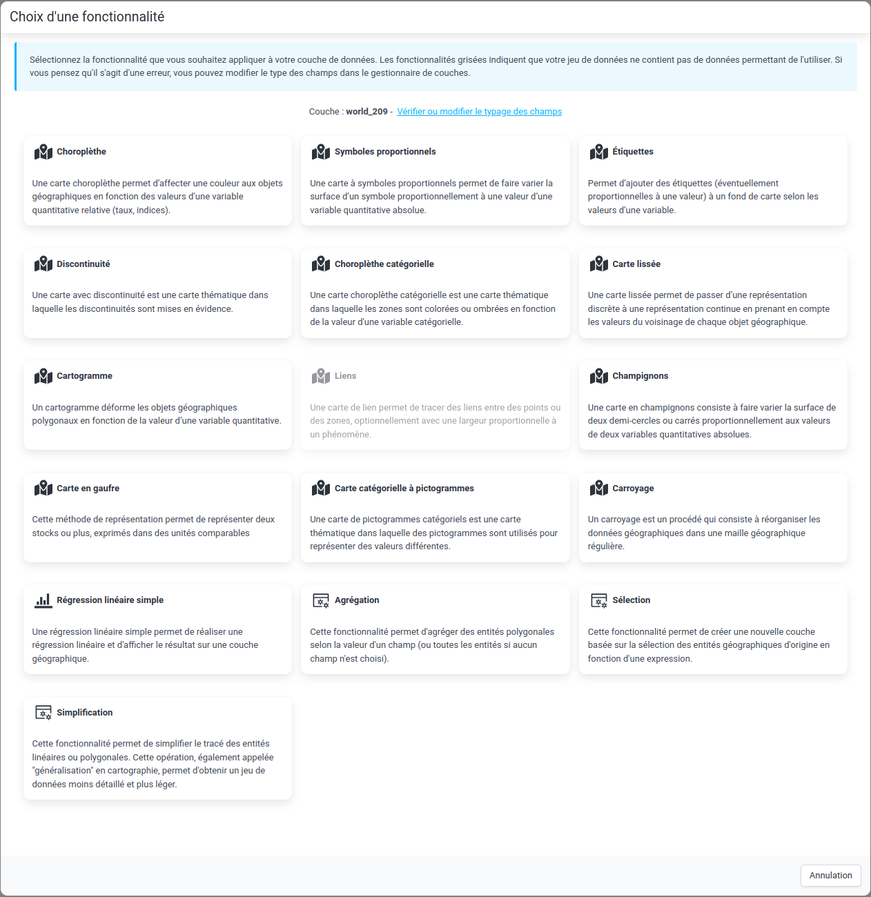
Layer creation
 Window for creating a new representation or a new layer
It is possible to create a new representation from a layer of geographic data or from a data table.
The available features depend on the type of data (geographic or tabular) selected and the type of variables contained (stock, ratio, etc.) in the data.
The grayed-out features indicate that the option is not available for the data contained in the layer in question. If you think the option should be available, check that the data is correctly typed (see Field typing).
After choosing the type of representation, it is necessary to choose the various parameters specific to the chosen representation (for example, the field to represent, the type of discretization, etc.).
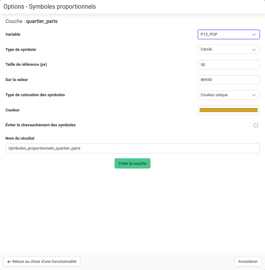 Window for creating a representation in proportional symbols