Example datasets
Magrit offers several sample datasets. The data they contain have been chosen to enable testing of the application's various representation and analysis functionalities; these datasets are not, however, intended to cover the various needs of users for base maps or thematic data.
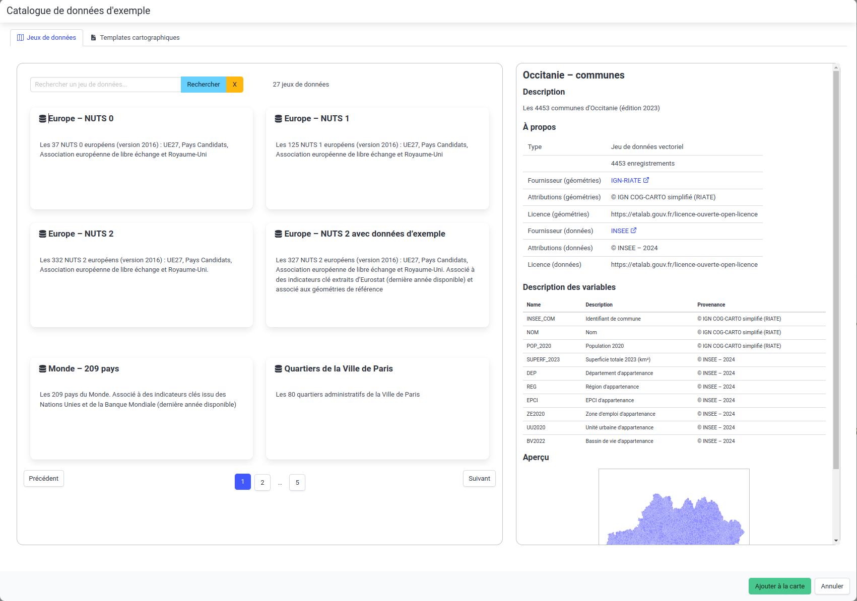
 Dataset selection window
Datasets proposed in the application
NUTS0
2016 version.
NUTS1
2016 version.
NUTS2
2016 version.
NUTS2 (with Eurostat data)
2016 version.
NUTS3
2016 version.
Countries of the world (209 countries version - with World Bank / United Nations / Wikipedia data)
Paris city districts
Communes de France métropolitaine
Edition 2023.
Communes de France métropolitaine et DROM
Edition 2023.
Communes de France métropolitaine et DROM (cartographic model)
In this version, the DROMs have been moved closer to mainland France for better data visualization.
Edition 2023.
French communes by region and DROM
The communes, 2023 edition, are available for each of the French regions and DROMs.
Cartographic templates
Europe
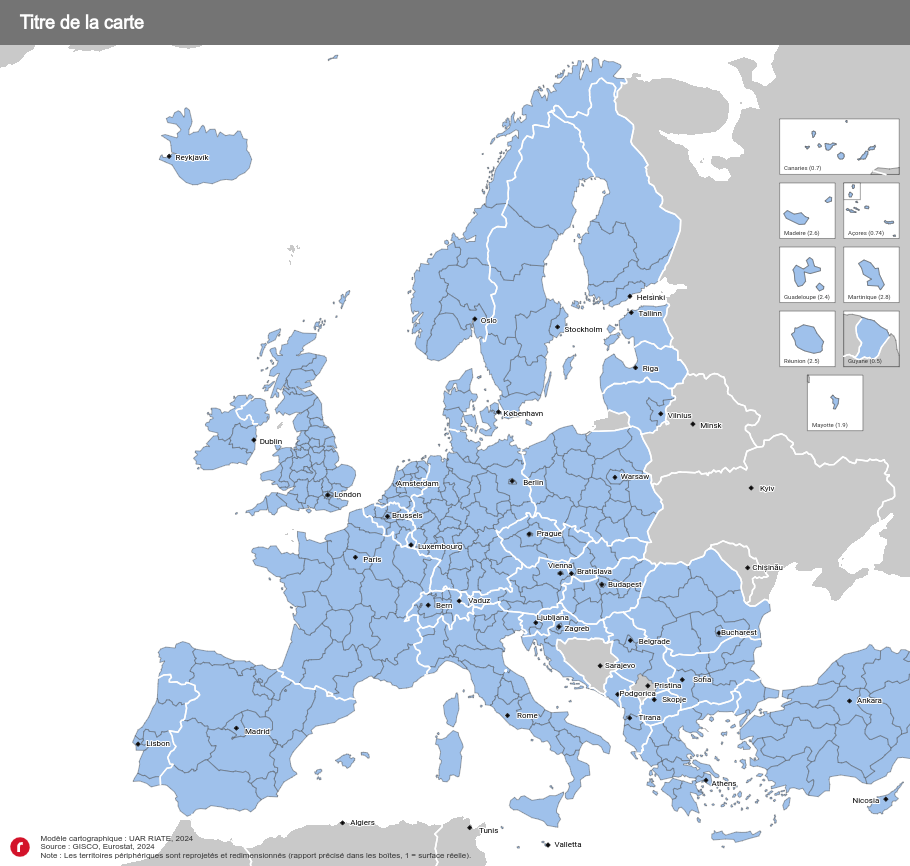
The cartographic template contains two main layers, NUTS 2 and NUTS 3, as well as a number of layout layers (neighboring countries, capitals, boxes, etc.).
In this template, the outermost territories of the European Union are brought closer to continental Europe and arranged in boxes for better visualization.
The European continent is represented in the official map projection of the European Union (EPSG:3035).
 Template cartographique Europe
France
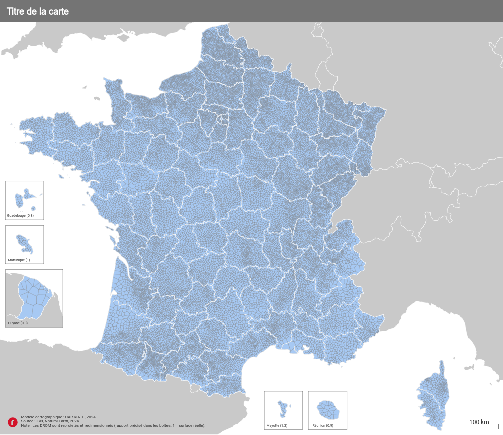
The template contains a main layer of communes in mainland France and DROM, as well as various layout layers (neighboring countries, boxes, etc.).
In this template, the overseas departments and regions are brought closer to mainland France and arranged in boxes for better visualization.
Metropolitan France is represented in the official map projection (EPSG:2154).
 Cartographic template France