Choosing a cartographic projection
The cartographic projection is a fundamental element in the creation of a map. It allows the representation of the Earth's surface on a flat surface. The choice of projection depends on the purpose of the map and the area to be represented.
In Magrit the default projection is the Natural Earth 2 projection.
You can change the projection of your map by clicking on the "Cartographic projection" button in the left side menu.
Dropdown menu of projections
The dropdown menu of projections allows you to choose from a list of predefined projections.
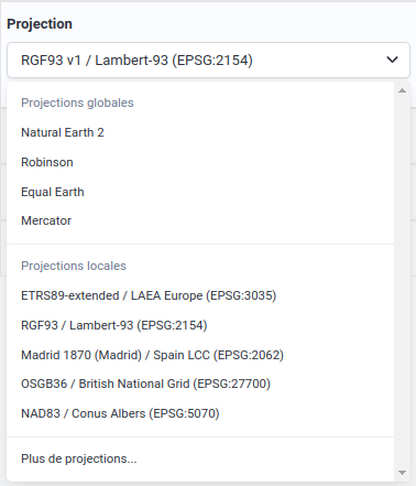 Dropdown menu of projections
Customizing the projection
When using a global projection, it's usually possible to customize:
- its center (on λ, φ and γ axes),
- its standard parallel(s).
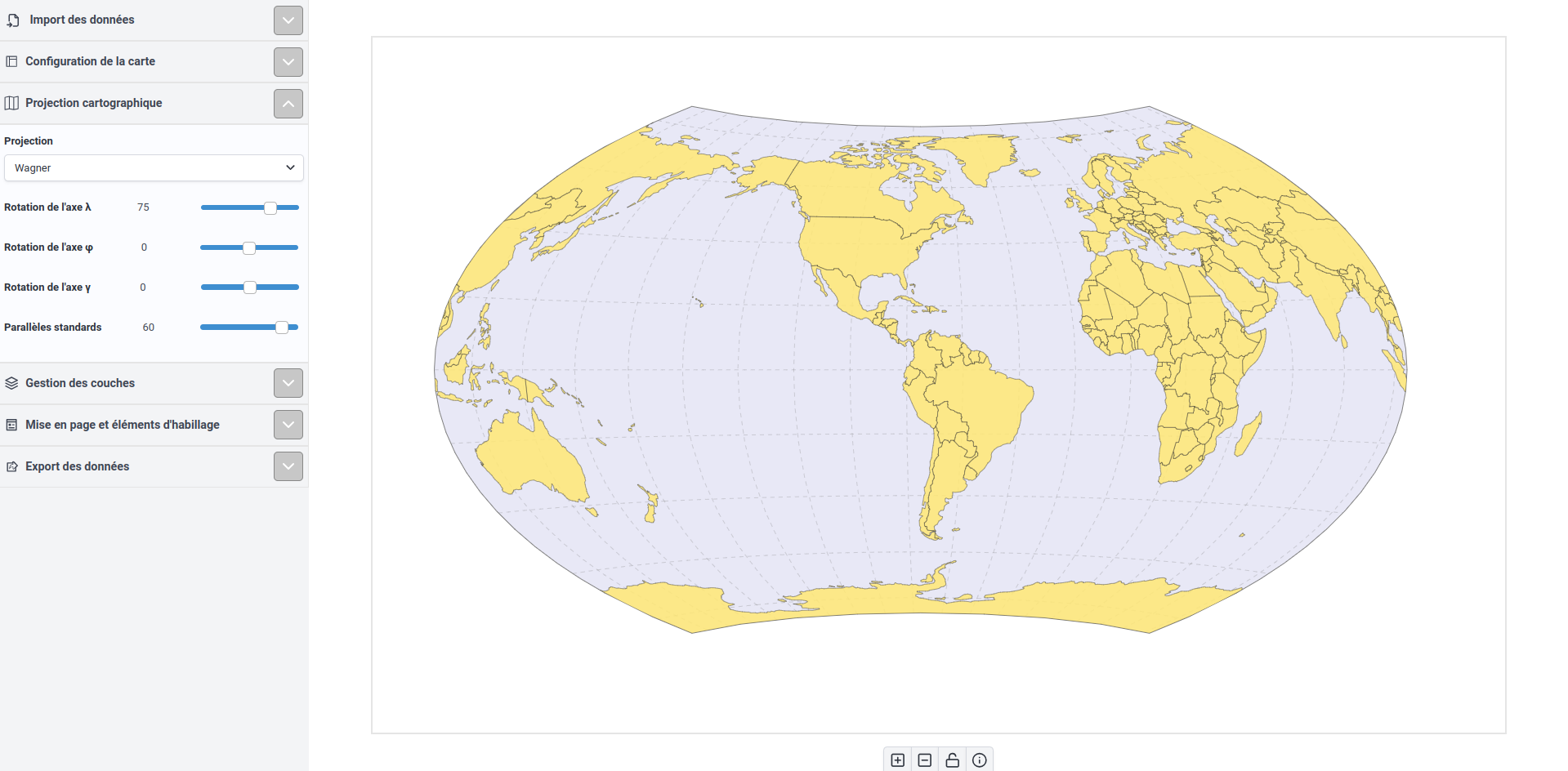 Customizing the projection
Window for projection selection
Global projections
Global projections are projections that generally represent the Earth as a whole (or on the scale of a continent).
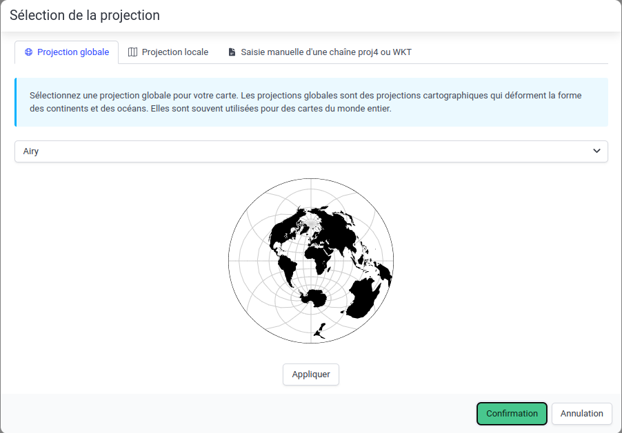 Selection of a global projection
Local projections
Local projections are projections used to represent a smaller portion of the Earth (e.g. a country, a region).
These projections are provided by the proj4js software library and are based on the EPSG database.
You can search for a projection by typing its EPSG code (e.g. "2154"), its name (e.g. "Lambert-93") or the area to which it applies ("France") in the search bar. When the EPSG code of the desired projection is known, it is advisable to use it to avoid any ambiguity.
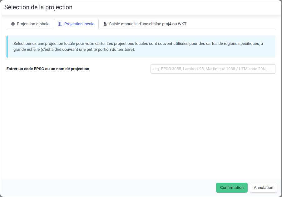 Selection of a local projection
Using a projection from a Proj4, OGC WKT, ESRI WKT or OGC WKT 2 character string
It's possible to use a projection from a Proj4, OGC WKT, ESRI WKT or OGC WKT 2 character string.
Simply copy and paste the string Proj4, OGC WKT, ESRI WKT or OGC WKT 2 into the dedicated field and give the projection a name.
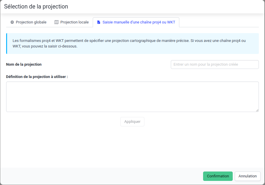 Creation of a projection from a Proj4, OGC WKT, ESRI WKT or OGC WKT 2 character string